Lost railways
Lower Edmonton Low Level and the line to Angel Road
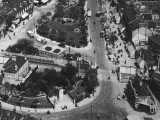
Some youngers readers, or older ones who don't know the area very well, might be surprised to know there was a second station at Edmonton Green. In fact it was the original one. Eastern Counties had a line from Stratford north towards Broxbourne and Hertford that linked in to their line to Shoreditch (later renamed as Bishopsgate). Around 1849 a single line branch was added from Water Lane station (renamed Angel Road c.1900) to Enfield Town that ran across the Green as can be seen in the photo above left.
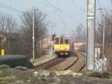
Edmonton station at high level opened in 1872 on a new Great Eastern double track line to Liverpool Street via Seven Sisters and Hackney Downs at which point the original station was renamed from Edmonton to Edmonton Low Level. In 1883 it was renamed to Lower Edmonton Low Level (and the high level one to Lower Edmonton). Edmonton Green (Lower Edmonton) station does have slightly curved platforms and as can be seen in the modern photo (above right) the line curves away even more just north of the station to pick up the alignment of the old Angel Road to Enfield Town line.
Although it might seem that the low level station would have become somewhat redundant after the high level station opened, it continued to have goods traffic and also a number of workmen's trains. Indeed a second platform was added c. 1900. However the service became less popular after the Great War and the service was reduced accordingly until in 1931 the last remaining morning workmen's train was withdrawn. An evening service of one train from Stratford to the station continued until the outbreak of war in 1939 brought an end to regular passenger services. Goods traffic continued though and from April 28th 1957 there were special passenger workings on certain weekends to allow engineering works on the high level branch to prepare for electrification.
In an article in The Railway Magazine in November 1959, Edward Treby was still seeing a future for the line post electrification because of the goods yards at The Green and at Angel Road station and because of the convenient link it provided to and from Northumberland Park and Temple Mills marshalling yards. However the line was closed for good at the end of 1964 and lifted in the middle of 1965.
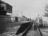
The photo above left shows the original platform of the low level station running on the south side of the single track from the level crossing towards and beyond the Cross Keys. A public footpath runs across the platform about halfway along and steps were inset into the unusually low platform. A board was placed over the steps when a train was at the platform. The second photo looks along this platfrom from the level crossing.
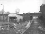
The second platform was on the other side of the level crossing and ran under New Road bridge. It was a normal height platform. The third photo shows the remnants of it in 1965. The railway bridge still existed in 2004 linking the service yards for the shops under The Broadway car park with those of the South Mall. However by early 2005 it had been demolished as part of a major new rebuilding project.
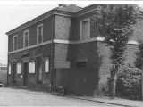
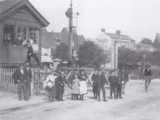
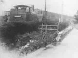
The station house is shown in the first photo above and the second photo shows the signal box and level crossing in 1904. The third photo dates from c.1880 and turns up everywhere even though there isn't an awful lot of detail you can make out from it.
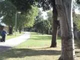
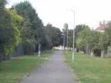
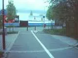
The old station may have been obliterated but there is plenty of evidence of the line of the railway. The old railway bridge could still be seen a short distance along New Road from the south until it was demolished in early 2005 but much more significant is that the footpath from Plevna Road to Montagu Road occupies the old track bed. The first photo above shows the path from the north-west end, the second the south-east, and it is clear that although original line was single track there was always the option to double it.
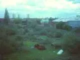
There was once a level crossing on Montagu Road (there is a photo of it in a local history book if memory serves me correctly) but now the footpath just ends. However on the other side of the road it is noticeable that there is a dropped kerb and, perhaps surprisingly, behind the hoardings the old trackbed survives as waste land. Indeed it looks like all the old railway land remains except perhaps some immediately next to the station where there seems to be a scrap metal business and that needed for the bridge supports for Conduit Lane. I thought perhaps this area might be used to improve the terrible access to Angel Road station but having seen the site for myself I see there is quite a distance from Montagu Road to the railway and the platforms are quite a way to the south too. They could probably make a great park-and-ride station there though.
Lottery funding was awarded for a community park at the end of Rays Road but it tooks so long getting going that the funding was withdrawn. Last time I heard anything (back in about 2003 or 2004) some other organisation with regeneration cash was intending to build the park though it seemed it might be at the end of Kenninghall Road instead. Either way it sounds like it will use part of the old railway (probably more the goods yard area). Indeed it sounds like some of the the delays may have been due to confusion over the ownership of the land (presumably it remained the property of the successors to British Rail but you would have thought that, as all the rest of the railway land has been built on or used for a path, this ought to have been resolved years ago).
Angel Road used to be accessed from the south side of the Angel Road flyover but this whole area has changed dramatically. To cut a long story short the entrance is now on the top of the Conduit Lane flyover which is about 150 yards north of Angel Road. It is on the north side so to get to the platforms you go down steps which take you under Conduit Lane and then there is a path by the side of the tracks which runs for about fifty yards before you even come to the end of the platforms. If you want the London bound track you have to go over a footbridge too.
Nick Catford's sites are always entertaining reading and his superb Disused Stations site has a page on the Low Level station and the line towards Angel Road with a nice selection of photos that put this page to shame.
Edmonton Junction and the goods yards and sidings
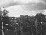
There was more to the stations than just passenger platforms. The area from 'Edmonton Junction' (where the single track low level line merged with the double track line) to The Green had a goods yard with a number of sidings and the area immediately next to the high level line had two to serve the coal yards. The photo on the above left was taken in 1961 looking from the footbridge between Croyland Road and Chicester Road. The junction itself would have been just north of the bridge. None of this remains and all the pointwork has long since been removed along with points in the high level station. However you might consider that the footbridge does have a wider span than needed for just the two tracks so there is some evidence there of the third track.
Angel Road junction and the goods yards
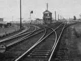
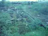
The first photo above shows Angel Road junction at the other end of the line c. 1959. Angel Road also had some goods and coal yards as you might see from the extra sidings in the photo. The photo on the right taking from Conduit Lane looks like it might show an old loading bay or something like that.
Bury Street Junction and the level crossing
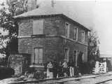
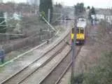
The picture above left shows the level crossing at Bury Street before there was a road bridge. The crossing building managed to survive until the 1960s. The road bridge appears on the 1894 OS Map where it is clear that the embankment and bridge run to the north of the level crossing and the peculiar layout at the ends of Croyland Road and Chichester Road and the casually placed garages (now redeveloped on the Croyland Road side) suddenly make sense as highlighting the old line of Bury Street. There is no obvious trace of the level crossing in the modern photo of the area (right).