Hertford Road
The Hertford Road is the name given to the A1010 from Edmonton Green to the boundary with Ponders End (and beyond, but that is beyond the scope of this site). I thought I'd take a closer look at it (OK, OK, I walked along it one day and I had a camera, I admit it...).
The Hertford Road starts where The Green finishes. These days some maps restrict The Green to the roundabout so anywhere north of Balham Road would count , whereas others have it drifting along to around about the North Square of the shopping centre. As there isn't anything that needs an address for the first couple of hundred yards it can remain a bit vague. Until the area was redeveloped The Green really applied to the area from the low level railway line (next to Salmon's Brook which you can still between the flats) up until somewhere just short of the New Road junction. The Exhibition pub had an end plot where Town Road crossed New Road and had a Hertford Road address. Caters was next door and was on The Green. So roughly level with the end of the shopping centre is about right.
The Green to Croyland Road / Bounces Road


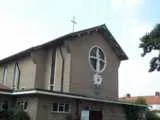
Before they trashed the area in the 1960 and 1970s there would have been shops on both sides of the road up to Monmouth Road (a list of the shops in 1937 is elsewhere). Now there is the Edmonton Baptist Church on one side (above left) and on the other several blocks of flats and/or maisonettes on Osward Place (next three photos) set back a bit from the road — so far back you wonder why they felt so desperate to obliterate the old buildings.


The exterior stair wells and waste disposal areas are a distinctive feature of the Osward Place estate. During the first half of 2004 there were temporary staircases in place and the structures looked like they are being refurbished somewhat. It looked like windows are being cut into them and it seemed likely they would be barred rather than glazed to improve light and ventilation. As can be seen in the photo above this is indeed what happened. It can also be seen just what a difference a simple coat of paint can make.
The older architecture starts with the Edmonton United Services club and a short parade of shops leading up to Croyland Road (above right). The corner building is visible in photos of the area from Edwardian times.
The other side of the road is a little easier to deal with...


The Crescent dates from the early 19th Century (1820 tends to be mentioned). It runs from Monmouth Road until just short of the junction with Bounces Road. It would originally have had a carriage sweep thingy across the front rather than the individual gardens and it would be nice to see that restored (some hopes!). The Edmonton Heritage Trail material points out that is has had additions at both ends and this is highlighted because the pediment is off centre. The north end displays clear evidence that it was intended for it to be further extended onto the site that is now the petrol station.
It is a classic example of the status of Lower Edmonton as a relatively upmarket and well situated Middlesex village before the railways came and changed the character of the area.


The Crescent today is actually looking a lot better than it did in the 1970s as it suffered quite a long decline. The two photos above from 1906 show the carriage drive to the front was already looking pretty sorry for itself back then. The view across Hertford Road on the left is of interest because it shows the same buiding on the corner of Croyland Road as is there today and also shows scaffolding up around St Edmunds church which was still under construction.
Croyland Road / Bounces Road to Bury Street


Croyland Road and Bounces Road form a slightly staggered road junction and on the west side of it is St Edmunds Catholic Church (left) followed by mostly housing (photo right) up to Bury Street.


On the east side is St Edmunds primary school (photo right) and then the King William IV pub (centre right) on the junction with Rosemary Avenue. There is then another Turkish (?) supermarket (centre left) occupying a building that was for many years Burridges, who I suppose were a sort of timber merchants come ironmongers type place.
Burridges occupied the site of some older cottages (above left) which were demolished in 1906. They were called Saddlers Mills Bridge Cottages after the stream that crossed the Hertford Road near here. The current course is in a culvert on the south of Bounce Road but the maps suggest to me that there was another course nearer Bury Street (there might still be for all I know). This area was sometimes known as Saddlers Mill Bridge and marked as such on maps.
Bury Street to Houndsfield Road
On both sides of the road the pattern now becomes mostly parades of local shops interspersed with houses. I have listed all the local shops on the Hertford Road in 1937 on another page.


Occupying the corner plot on the Bury Street junction on the west side is Maton Hall (left), though the chances are that name isn't used for it these days. I have always associated it with the redundant St Michael's church (which sits just behind it) on Bury Street and assumed that it was the church hall. However I am told that the church hall is, or was, tucked away behind the vicarage (or at least it was by the 1970s) so this doesn't seem to be the case. I am wondering if in fact this was the "St Michael's Mission Hall" that was here in 1902 and seems to be indicated on the 1894 map (I believe it may have been built in 1888). Certainly there appears to be a small cross on the roof detailing and it does look like it could be late Victorian. The church also seems to echo certain shapes and patterns in the architecture of the hall to suggest maybe it was influenced by it.
The building has clearly been extended and altered on the ground floor later in its life. Carole Jones tells me it was owned by the Co-Op and used for youth clubs and things once upon a time (they are listed there in a 1937 directory). I always thought of it mostly as a bingo hall when I was young. For a few years in the 1990s it was a night club called Club Hertford or Hertford's. The hall is being used by a charismatic church as of July 2002.
A further contribution to the message board suggests that Maton Hall may well have been used as the church hall originally but was replaced by Bassishaw Hall further up Bury Street opposite Galliard Road (now the Newbury Unit). That hall was sold to the council and a new one built on the vicarage grounds c. 1964.
Next door was Tom Clay's car parts shop (centre left) which had been around quite some time but has now close down. I seem to remember Tom Clay's originally being on the other corner of Bury Street though and this store seems relatively grand for its surroundings when you examine it more closely. I can't remember what was here before but it does have that look about it of something to do with the Co-Op. Carole Jones confirms a Co-Op grocery being next to Maton Hall so I should imagine this is it. I have some hazy memory of the Co-Op milk depot once being behind the houses here but maybe I am imagining things.
Continuing down the road there are many more local shops. The third photo shows the parade from Sutherland Road (off camera to the left) to Denny Road on the right. I remember the newsagents on the left as a sports shop called something like Mannal's. I seem to remember it had two shop fronts and the other half was probably a toy shop or something like that. Also notice the Gold Flake advert still visible on the side wall of Adam Kennedy. I find it a nice irony that the flats above and to the side of this estate agents are let by their rivals W. J. Meade across the street.


Looking back along the parade you can see number 193 – 195 which is now a launderette and how it is actually a separate building with the houses butted on to on each side. The pediment says ECSL 1906 and indeed I can remember it still being a London Co-Op into the 1970s at least. At least I think I can. Maybe it is the other one I remember...
This building has figured in David Waters' researches and he has contributed a superior photo of the building and a close up of the pediment, as well as an old photo dating from 1913.
The next parade is Denny Road to Henderson Road, and there is yet another fried chicken outlet I notice. These seem to be everywhere now. Henderson Road to North Road is mostly housing except for the corner shops and a hairdresser's (I think this shop was my barber's as a kid). North Road to Houndsfield Road is again just houses plus the corner shops. I seem to remember there was a butcher's shop somewhere along here once upon a time which was the first choice for our family, but there doesn't seem to be one there now :-)


Back on the east side, next to Burridges (as was) is the little structure shown in the photo above right. I have always assumed this to be an electricity sub-station though I could be wrong. Next to it the first pair of houses are named "Alpha Cottages" and then there is more residential housing running past Grosvenor Road until the short parade of shops leading up to Lowden Road which shown in the photo second left (with the King William IV in the background). The houses are all in the same style as Alpha Cottages but set a yard or two further back from the road. The terrace leading to Grosvenor Road is called "Ellacombe Villas" and that leading from Grosvenor Road to the shops is marked as "Jasmine Villas". According to a 1902 directory the parade of shops were known as "Bon Marche". Lowden Road Post Office on the corner has looked better on the outside, to say the least, but is still open even though you could walk past it and think it wasn't. After the shop next door, which looks empty, is Meade's Estate Agents, an Off-Licence and one of several Stanley Racing bookies in the area. There was certainly a butchers shop along here back in the 70s and 80s (and for many years before probably) but really I've only ever dealt with the Post Office.
Back towards the camera is houses again until Forest Road and then between there and St Joseph's Road is Forest Road Clinic set well back from the street (above left) and then what looks like is probably an old folks home (but see below). The small "green" in front of the clinic (rather a generous description for a semi-neglected patch of land) is apparently going to be a "Golden Jubilee park", whatever one of those might be. Passing by in July 2004 I noted that that a children's play area had appeared in half the plot and seating alongside a path had appeared on the other. So I guess this is said park.
It was indeed said park and it was formally opened later in the year but not without a near embarrassment as the plaque that had been laid down a few days before opening has "Councillor" spelt wrong.

The site next door to the clinic was owned by the council and I never really knew what it was. I thought perhaps it might be sheltered accommodation or something but anyway it is no more and it seems I never did get a photo of it. There has been a land swap deal between the council and the local health authority and a new Primary Health Centre is being built for opening in 2006. When it opens Forest Road clinic will close and the council will take over the land.
This area was once the location of "St Mary's Terrace" which is shown two thirds built on the 1894 O.S. Map. There were five shops between Forest Road and St Mary's Road, and a further eleven leading up to St Joseph's Road. St Mary's Road is wonderfully described by Sellick as a place where "the bobbies went around in twos and any cat with its own tail was a definite tourist". The policemen really did patrol there in pairs so he isn't joking about that. It really was about as rough as Lower Edmonton got. It was developed at the end of the 19th Century and originally ran onto the Hertford Road directly instead of being tucked away round the back as it is now. This whole area was obliterated in the 1950s.
Houndsfield Road to Tramway Avenue


Wandering off the high road briefly, just up Houndsfield Road on the left was a library (left) next to the William Preye centre (an old folk's place). The library itself was up on the first floor and reached by an entrance to a staircase and I've no idea what was on the ground floor. It seems to be Age Concern now. At the end of the road opposite Houndsfield School and before the Henry Barrass Stadium was a lido. This opened in 1927 at an original cost of £8,000 and had a 150 ft by 100 ft pool. In 1935 another £8,700 brought a filtration plant, loudspeakers, a refreshment pavillion and tea terrace, a sun-bathing beach and various building extensions. It closed in 1979 and there is now a residential home there. The Henry Barrass stadium had a cinder athletics track that is now grassed over and tended to be used for school cup finals and inter-school sports finals as well as amateur football teams.
On the north side of Houndsfield Road stands the Cock Tavern (centre) and then a parade of shops (right) leading to Cleveland Road. The first shop that is now a furniture place was for many years a gent's clothing shop named the Carlton Stores which was handy for Indestructible socks and flat caps. I see at the end of the terrace is a chemists. I can always remember a chemist at that end of one of the parades here and I guess it was probably here. I also remember coming to a butchers shop that was towards the right hand end of a parade and I think it was this one (I have been reminded it was named Evans).
We are now at about the same place on either side of the road in an area that is generally called 'Tramway Avenue' after the bus garage just up the road (and before that trolleybus and tram depot).


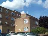
Concentrating on the west side for the moment, on the corner of Cleveland Road is a Bon Autos second hand car place. It, or a predecessor, has been there for as long as I can remember. They have another place opposite it as can be seen on the right on the picture. The parade from there to Ripon Road is shown in the second photo and features "the cheap shop" itself, Buyrites, and I see that next door the opticians is still there. At this end is Target estate agents. The first floor shows the line of the original shop front at ground level and here for many years was an ironmongers sort of place (well I suppose they could have been a builders' merchants) called Allen's.
Between Ripon Road and Bridlington Road are some relatively "new" looking flats that can be seen in the third photo. The development is called St Clements Court. These are actually warden controlled flats for the elderly and, I am told, were built around 1974. I can't remember what was there before. It may have just been waste ground unless it was a car park.
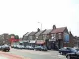
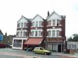
There is then the parade to King Edward's Road starting with the petrol station and featuring what to me as a child was *the* Post Office. Shersby's the estate agents have been established since 1938 and can be seen to the left of the parade. I seem to remember the petrol station being built in the late 1970s and I should think it replaced more shops similar to the rest of the parade. I have a feeling these were damaged by fire. The next photo shows the other side of King Edward's Road. There is then mostly housing heading towards Bedford Road.
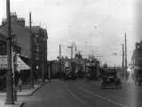
As usual, Ron Roe's pre-1951 recollections can be drawn upon here to some extent. The post office was well established back then and had a hairdresser's to the left and on the right on the corner was a cafe. The grocers in the groups of three was something like Price's or Page's with something office like on the left as it is now (it is a solicitors). On the right was either Shersby's or it was a confectioners in which case Shersby's was to the right again off camera.
The photo on the right above shows the area in the last two photos some time in the early 20th Century.
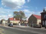
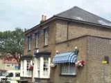
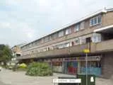
Back on the east side of the street, at St Joseph's Road we start with rows of shops and housing (right) that I think probably date from the early 1970s because I have a hazy recollection of them springing up as a child. They run up to Tudor Road. There is no mention of shops here in 1937 so I should imagine it used to just be a residential terrace. It is shown completed on the 1894 map.
Between Tudor Road and Elizabeth Ride (above centre) there is a private members club, the K.C.M., that has a bit the look of a converted pub. However it was the Houndsfield Working Mens Club in 1937 and it probably wasn't all that old then so it was presumably built for that purpose.
We are then at the area that I consider Tramway Avenue itself (even though that is actually the road at the side leading down towards the site of the old depot/garage). Here opposite the bus stop there were public toilets and I think perhaps some facilities for the bus drivers and conductors. They have all gone in recent years to make way for housing (surprise, surprise) and the only thing I recognise from years gone by is whatever you call that thing in the picture centre left.
The early C20 photo of Tramway Avenue on the left shows the horse trough below.
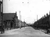
Tramway Avenue to the boundary
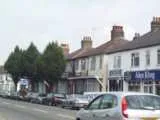
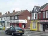
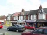
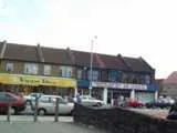
Still on the east side, these photos show the shops from Tramway Avenue on the right to just west of Causeyware Road. Today the line up from left to right is Xsessive Records, Alex King estate agents, a podiatrist, Castles estate agents, Home Touch (is that a cafe?), Richard Morris butchers, a newsagents, another fried chicken outlet (aaaagghhhh!!!!), a hairdressers, a double fronted tile shop and a triple fronted electrical wholesalers. The corner plot is a small second hand car dealers.
I can remember the newsagents being there, and later in the 70s Ripspeed opened up along here. However for me the parade was defined by Letherbarrows greengrocers which was on the corner where Home Touch is now. Ron Roe can go back further than me to around the war years and he would think of it as Mr and Mrs Carey's shop. He can also go on to name the butcher as Bob Bennett, the newsagents as Eddie Fry's, and then remembers a shop called Belcher's, a haberdashers and a sweet shop (this sounds familiar to me too). He speculates there might have been a cafe at the Tramway Avenue end. He also says the little parade north of Causeyware Road must have been converted after his time in the area (though in fact businesses there are featured in the 1937 directory).
I notice that the tile shop doesn't match the surrounding shops and also seems wider than it ought to be, and also I would have expected a different roof line somewhere above the electrical shop in order to match the rest of the parade (in fact when you look at the photo below you realise all of the roofs were once the same so only three of the ten are original). To add to the confusion the post code database suggests that the tile shop covers three numbers and the electrical wholesalers only two which is the reverse of what the street fronts suggests. Obviously something has happened to this building in the past and Ron Roe doesn't recall any war damage so maybe it was fire or something. It still doesn't quite explain the extra width of one front though.
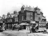
Something that became clear from a couple of photos on the trams and trolleybuses page is that the corner plot once housed a taller and more fussy building and there was indeed clearly a cafe here. The 1894 map shows something on the corner but not the rest of the terrace so perhaps it dates from the time of the tramway opening. The Waltham Cross and Edmonton Tramways book yields a photo of it (upper one) and also shows that the rooflines have changed.
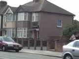
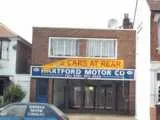
Switching back to the west side of the road again, the picture on the left shows the footpath that leads to Lingfield Gardens and then on to Hadleigh Road and Jubilee Park. The house to the left was my Doctor's surgery (a Dr Lanford) and Ron tells me further back it was his doctor's too (a Dr Teugan). Dr Lanford is back here with his Obesity Clinic these days. Another landmark for me is the little second hand car dealers (centre left), which looks suspiciously shut in the photo but now has new owners. This marks the change from the 1930s style housing that leaked out from Hadleigh Road onto the high road (King Edward's Road has older style buildings) into earlier style housing running up to Bedford Road.
On the message board it was commented that a house on the corner of Bedford Road was once the rectory for St Alphege's.
The west side continues with some flats and then a terrace of council stock houses and private houses known as Byron Terrace leading up to St Alphege's (centre right) which lies in a small churchyard leading back to Rossdale Drive. There are then some 1930s period houses up to Galliard Road. In the middle of Byron Terrace is a large driveway leading to the Allotments which stretch all the way to Galliard School.
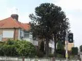
Now "What is the only tree a monkey can't climb?". The Monkey Puzzle tree of course, and it is good to see the monkey puzzle on the corner of Galliard Road (right) is flourishing. Indeed there are now two of them.
There is then older style housing going past Cuckoo Hall Lane for a way with the interesting feature that each house has its own name clearly engraved on it.
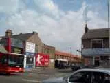
Returning to the east side of the road, opposite Bedford Road is St Alphege Road (upper one) which has had a tyre shop on one corner for as long as I can remember and has a mini-cab office on the other. However Ron will remember the former as a sweetshop, and the latter as the hardware shop Mr Johnson converted from a house having previously had a mobile shop. He will also remember the newer looking houses in the back as the location of the United Dairies depot.
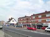
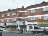
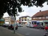
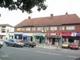
The road continues with some flats that look like they are 1960s at the very latest, and probably earier. We then come to an area that is known to me as "the bottom of Galliard" and I accept no substitutes!
The parade to the south of Nightingale Road (pictures right) isn't terribly significant to me, except as the location of a convenient chippy for when one came home late in the evening by bus (and oh look, on the right there is a fried chicken outlet!). The other side (pictures left) was memorable for having a small Tesco towards the right hand end, and also for a barber's when I was very young which was reached by going round the back and up some stairs to the first or second floor. I'd always imagined this was a 1950s or 1960s development but as there are shops here in 1937 and the local area is 1930s build I think it probably is 1930s build too. Indeed now I look at it I am baffled as to how I ever thought otherwise.