Church Street
Church Street has had its share of change and development but if there is anywhere in Edmonton that has managed to preserve any of the past then Church Street is it and there is a comparative wealth of photographic material and information to play with. There are several listed buildings and even the most innocuous looking buildings are more interesting than they may seem at street level.
As with many of my pages, I may gloss over subjects that are covered on other pages (such as pubs or churches), providing links instead.


I shall start at the eastern end and work my way west and that means starting with the railway bridge and on the south side a back entrance to the station. have shown a roughly similar view from 1954 and 2002. The current bridge was dropped in over a weekend in the 1990s and I have got used to it now though for a while it did seem strange seeing this lightweight looking structure which is actually four separate spans for the track beds and the sides/walkways. You can even see where it is jacked up to the right levels. The old bridge was a much more substantial looking structure. I notice the road seems a little narrower than it is today but I can't work out where the extra width has come from.
In the 1954 photo you can see just beyond the bridge is a tiny little brick built hut and remarkably it is still there today as a one room office for D & J Pegrum Memorials.


On the north side between the railway bridge and Lion Road there is first an anonymous office block (probably dating from the 1960s) with four storeys and shops on the ground level , then a terrace of five small shops, and then two more adjoined buildings with two shop fronts each. The three sets of shops are similar in style but not identical and together form Keats Parade.
Keats Parade is so named because until 1931 this was the site of a Georgian House (above right) where in 1810-1816 John Keats was apprenticed to the surgeon Thomas Hammond and there is a blue plaque commemorating this on the wall.


On the south side the street frontage seems equally anonymous but when you look up you will see that the first three shops up to and including Kings estate agents may well not have a lot to say for themselves but these abut what is actually a converted terrace of 18th century mansard roofed cottages (above left). The narrow road next to them, which is now just an access way leading to the Barbot Estate and the rear of the shops, is actually the remnants of Cedars Road which was particularly noted for its near slum housing. The new housing on what I still call the Barbot Estate can be seen at the end of the road.
Next comes a white painted rendered building (20/20A/22/22A) which houses solicitors' offices (above centre). This is an early 19th century terrace of stuccoed cottages which were part converted to shops back in the 19th Century. Abutting this terrace is number 24, which is an 18th century red brick cottage which was the house of the Charity School Mistress. Next door to this is the former Charity School which was opened in 1784 and prepared girls to go into service, and this explains the statuette of the girl in the niche above the door (above right). This is now used as a public hall. The white cottages, the Mistress's house and the hall are listed Grade II (Group Value).


Going back to the north side of the road, the first photo above shows the Grade II* listed Lamb's Cottage pictured around 1910. It is on the west side of the junction with Lion Road. The second photo gives a better view of the cottage and highlights a building on the right where there is now a car park.
An old O.S. map shows the cottage as being semi-detached and certainly that big lump on the left is grafted onto the same building. Quite what belongs to what I really can't say. Looking at it today, the bit on the left seems to be the same size and shape up to the parapet as it is in the old photo but is brick faced and has different windows. It matches and now seems to be an integral part of Redford Lodge next door, albeit lower than the rest of the building.
The third photo above is taken from Lion Road and shows the roofline at the back of the cottage and the last one gives a typical view of the front i.e.lots of greenery obscuring the frontage!


The pictures above are taken from postcards dating back to Edwardian times (or thereabouts). The first one shows how the railings used to extend to the left of the pillar and the ivy covering the building on the left. The second one is a less familiar view as it shows the rear of the cottage. It also highlights the buildings on Lion Road where there is now just a small car park.


"Holy Joes" was a nickname for St Joseph's Hospice which has now closed with the building finding a new use as Redford Lodge, which is a medium secure psychiatric hospital. Looking at the photo on the left taken in the 1920s showing the old Jolly Farmer it is clear that there are different buildings in this location which confirms that the building is 20th Century. I guess I should be able to work that out for myself really just by looking at it and I should imagine it could well be 1950s vintage.


Returning to the south side, west of the Charity School is a terrace of houses and then Lower Edmonton N9 sorting office, or rather these days it is a delivery office. It is early 20th Century and listed Local Interest. Next to the sorting office, after an alleyway that used to lead to a transport company yard or something like that, is The Lamb public house, which was formerly a restaurant. This is converted from the first two houses of a terrace leading up to Victoria Road.


Opposite the Lamb is The Jolly Farmer pub which is much older but the current structure is a 20th Century rebuild. Next to the Jolly Farmer are numbers 19-21 which are a pair of early 19th C. four storey Georgian town houses listed Grade II. If you look closely at the doorway you will see that a 19th Century porch has been plonked across the arch and you will also notice that the window on the right shows the same arch and was also a doorway. However it is just as likely you have walked past them without a second glance!


Leading up to Winchester Road there is a short terrace of houses and then on the corner a late 20th Century block of flats (above left), looking somewhat up market from the usual offerings sprouting up everywhere from the likes of Fairview and Laing and indeed showing some interesting architectural details, particularly along the roof line. It is part of the Beechwood Mews development along with the building in the next photo(viewed from Winchester Road). A mansard roof with dormer windows? Just goes to show that they can do it when they try.


The first two photos above date from 1890 and c. 1900 and show the area west of the junction with Victoria Road and in particular the 18th Century Rose And Crown pub (Boudier actually dates the rebuild to the 19th Century, the pub itself is recorded in 1667) . Equally prominent next door is the Tudor Cottage. On the other side of the pub were some weatherboarded cottages thought to date back to the early 16th Century. The Tudor Cottage was a real curiosity and there is speculation that despite the name it may even have been medieval.
Unfortunately the Victoria Road junction was remodelled in the 1930s and all these buildings were lost. A new pub was built which is set back from the road somewhat and there is a green space on the corner now which looks plenty big enough for the Tudor Cottage to have remained intact. I am, of course, assuming the pub has the same location but I am led to believe it was built behind the site of the previous one and is a little smaller. It wasn't just in the sixties there were cockups it seems :-) The photo above right shows the area in 2002 and you can just see Victoria Road to the left.


On the north side of the road between Winchester Road and Church Lane there doesn't seem to be anything obviously exciting, just Ladbrokes betting shop (above left) and four houses in three different styles, though they are all 19th Century and the pair on the left in the same style can be compared and contrasted with each other to see how one has been altered. There was once a fire station on the corner with Winchester Road where there is now a small green space and Eccleston goes further and says Ladbrokes shop *is* the former fire station (I tend to disagree). The maps indicate the original police station was here in the 19th Century and there is a blue plaque on the wall saying this was the site of the offices of the Local Board Of Health then too. Who would have thought when you look at it now!
The green space on the corner now features a stone seat (above right) commemorating Charles Lamb and John Keats with an inchurch-strion on the floor. I forget when they put the seat there or if there was any particular occasion for it. Somewhere around 1995 perhaps. The inchurch-strion says: "Essayist and poet of Church St. Edmonton. Charles Lamb. Loved his brethren as mankind. John Keats. Beauty is truth, truth beauty." Pity they couldn't write "Lower Edmonton".
Discussion of the old fire station has been moved to its own page.


The thatched cottages in the pictures above are on Church Street at the junction with Church Lane (with the colour postcard showing Church Lane itself). They look kind of quaint but it seems you couldn't add sanitary to the dechurch-strion. In 1908 the neo-Tudor Charles Lamb Institute was built on the site. This is now the Tower Gym. It is quite a remarkable looking building if you step back to look at it and is Grade II listed. So at least something worthwhile replaced the cottages.


Opposite the Charles Lamb Institute is, of course, All Saints Church and I must admit once we get beyond there my knowledge of Church Street starts to get very patchy which is a little sad as we are only about 1/5th of the way along it! A couple of walks along it has helped me out though...

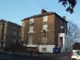
Treasures Of Enfield highlights numbers 71-77 - two pairs of four story 19th Century houses - as being of interest and that must be this pair here which lie between the Tower Gym and Latymer Road. The photo on the left above is interesting for showing how the Tower Gym looks somewhat less imposing from this end, and what on earth is that bungalow doing there!
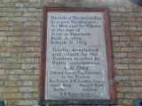
On the south side next to All Saints are the Almshouses. There is a big engraved plaque on the wall which you should be able to read in the photo and below it is another inchurch-strion to say they were improved and modernised in 1960.
Next door is the site of the original Latymer School which dates back to 1624 and was founded to educate the children of the poor. Modern sheltered housing called John Adams Court occupies the site now. The old voluntary National School associated with All Saints Church was next to it but set back from the road a bit more.
John Adams Court was also the site of the Edmonton Technical Institute. This was erected in 1912/13 and controlled by the trustees of the Latymer Foundation.
Eccleston talks of rows of three storey semi-detached Victorian houses in what was basically the posh part of Edmonton at the time and says that they were nearly all demolished in the 1960s except for one group which collapsed when being restored in the 1980s and was rebuilt using the original materials! This is on the south side of the road so assuming we don't count the basement as a storey and taking into consideration other architectural features he mentions it must be the following buildings....
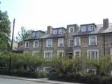
This terrace is on the south side of Church Street just past the junction with Latymer Road and leading up to the back entrance to Latymer All Saints Primary School. They do look odd as they are clearly an old design and are made with old materials yet they do not have any feel of age about them. If they were indeed rebuilt in the 1980s this would explain things. In one of her useful contributions to the message board, Debbie confirms this is the correct building and she believes that all but one of the group cracked during underpinning and had to be rebuilt. She thinks one may still be original and on its original foundations and having walked past it since I can confirm that the look of the right hand pair does support that belief.
If the rest of the buildings were demolished in the 1960s then one has to question where they were. On the south side the next rows of housing look very much like typical 1930s era suburban stock to me though past that there are some buildings that are some post-1960 dwellings. After that the road continues with mostly early 20th Century looking housing all the way to the Great Cambridge Road. However examining the 1867 and 1894 maps the terrace above seems to be indicated but the rest of the south side of the road is open countryside and the only site shown developed and not otherwise accounted for is the area between Latymer Road and what is now the site of the fire station. Here the road is now lined by the back gardens of the 1970s built houses in Wyldfield Gardens so it does seem to be favourite. However this would probably only provide enough space for a terrace about the same size as the remaining one and I was kind of inferring more.
The other problem is that the maps seem to show half a dozen detached buildings on the north side that look larger than those on the south side which are also much closer together (they are now linked but that could be a relatively modern alteration). Debbie comes to the rescue again and tells me that she remembers that in the late 1960s there were a couple of semi-detached houses here looking something like numbers 71-77 mentioned earlier. This seems far more consistent with the old maps. So yes there may have been another row of old houses that got demolished but it doesn't seem they were the same style as the above row as Eccleston seems to suggest.
Latymer Road in the late 19th Century was just a short lane about the size of Church Lane. If you look at it it today you do notice the style of housing changes and becomes more irregular as you approach Church Street.
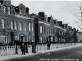
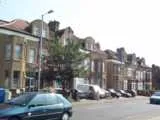
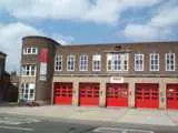
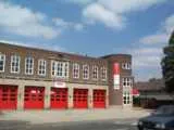
The rather neat looking fire station (right, obviously!) opened in 1941 and lies a little west of Latymer Road and east of the buildings shown in the left hand pictures...
The first photo above shows some 1881 built houses which are seen in 1906. If you see a resemblance between them and the old library on Church Street it is because the same builder was responsible. I note the direction of the shadows which places this terrace on the north side of the road and indeed if you walk past the fire station you come upon several rows of houses including some that are rather familiar (second photo).
These houses, and others of different styles but similar nature, line the street front on either side of and between the junctions with Arthur Road, Stanley Road and Tillotson Road and collectively were originally numbers 1 to 26 Queen Anne Villas. These roads form the Hyde House Estate which was constructed from 1881 onwards. I don't know what style of housing lies off Church Street (I do look down the roads as I walk past but I keep forgetting what I have seen!). As you might expect, there was previously a Hyde House on this site and it is marked on the 1867 map.
Church Street is actually marked as Hyde Side west of the church on the 1894and earlier maps and in Kelly's Directory of 1890 it is used as part of the addresses of the estate mentioned above and also for the few houses much further along the road.
The name Hyde does crop up rather a lot as Victoria Road was known as Hyde Lane back then (it started from Fore Street just south of Park Road in the south and took in old Cedars Road in the north), the first roads in what became known as the Barbot Estate had an address including The Hyde (and the pub was The Hyde Arms), and the name lives on in the roads known as "The Hydes". In 1920-2 The Hyde Estate was started which was supposed to be a "garden city" estate of semi-detached houses stretching from Pymmes Park to Church St and Victoria Road to Firs Lane. However they ran out of money so only built 10% of it :-)
On older maps the whole area south of Church Street and west of Fore Street is marked as "Hyde Field" so that could be the origin of it all. "Hyde" would almost certainly come from the Saxon word "hide". Exactly what a hide was is subject to debate among historians but it seems generally agreed it was a land measurement. However it was based on yield rather than area so it could be say 40 acres in an area of quality farming soil and 120 acres in a poorer quality area (those are just numbers, I have no idea of the right scale). Some suggest a hide was an area that could sustain one family, others talk in terms of a number of ploughs, others say a hide was a field divided into strips. Whatever it was it seemed to turn into a unit for taxation under the Normans, though quite how this unit was defined isn't clear.
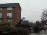
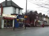
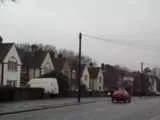
Returning to a discussion of the road today, I have already mentioned how past the rebuilt houses on the south side and the school there is a row 1930s style housing. This leads to Hydeside Gardens and beyond that up to Haselbury Road there are flats and maisonettes (photo left) that I imagine are probably 1960s built but I am not entirely sure. They actually face onto Gatward Green (off Haselbury Road). Alan Perry says on the message board that he was moved into a house on that estate from Barbot Street in 1961 which provides somewhat better dating evidence.
Past Haselbury Road there is another block of flats that I again struggle to date though it looks similar to one in Hydefield Court further along the road. After this the road suddenly drops back into late Victorian era housing with a few local shops and a terrace of small houses (centre). There is a Victorian letter box outside the shop here.
Once beyond the Victorian housing Church Street was largely open countryside until the 1920s and the rows of housing up to the junction with the Great Cambridge Road do have the strong triangular styling to the architecture that I believe is typical of 1920s housing in this area.
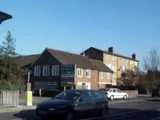
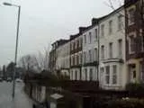
Returning to the north side, the road is a bit of a mixture up to the Cambridge Road. The large Victorian houses lining the road on the Hyde House Estate gave way to a large playing field. Squeezed between the two are two blocks of flats (right). Shall we guess at 1960s/1970s?
Notice the past tense when talking about the playing field. Part of this space is being used as the site of a new primary school which is shooting up rapidly and can just about be glimpsed in the photo (centre right). The new primary school opened in September 2004 and is named Starks Field. This reflects an old name for the site (on a c. 1600 enclosure map it is Starksnest Field).
Beyond the playing field there is a petrol station and then we are back to another terrace of 3 storey houses (centre left) that is again late Victorian. After that there are then buildings (left) associated with the sports club that occupies a large corner plot on Church Street and the Cambridge Road. The ground is apparently called the Hydeside Ground and is the home of Edmonton Cricket Club.
The sports ground doesn't occupy the corner itself where there is a little ornamental garden. It looks as if something is missing from it. I don't know anything about it.
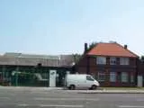
Just west of the junction with the Great Cambridge Road on the north side there is the milk depot (above left) which always seems to have changed hands on the infrequent occasions I pass it! It was a United Dairies one when I was young.
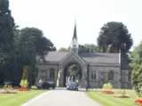
Opposite is Edmonton Cemetery. The chapels (above centre) date from 1886-7 (though Dalling suggests 1884 in one book which apparently is the year the cemetery opened).
The remainder of the road is mostly lined with what I consider 1930s era housing. OK it might really be 1920s but it is the basic look I mean. It seems a bit upmarket from e.g. the Latymer or Galliard Estates.
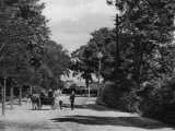
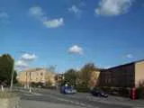
The road then bends right and then left again. The 1881 and 1894 maps mark this as Jew's Corner and Ridge Road, which joins Church Street here, was formerly known as Jew's Corner Lane. On the north side of the road here is an estate of late 20th Century housing (left) that contrasts dramatically with the rest of the road which is lined with between the wars building.
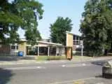
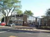
Past Little Bury Street the road bends sharply right to join up with Bury Street West and then left again to the Ridge Avenue / Village Road / Bush Hill Road junction. Here you will find the Ridge Avenue Clinic and Library (above centre ).
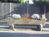
A rare sight these days is one of the Metropolitan Drinking Fountain and Cattle Trough Association troughs. I'd always imagined these were horse troughs but the reuse as flower beds seems sensible. This one, the only one I can recall seeing in Lower Edmonton in recent years, is opposite the Clinic.